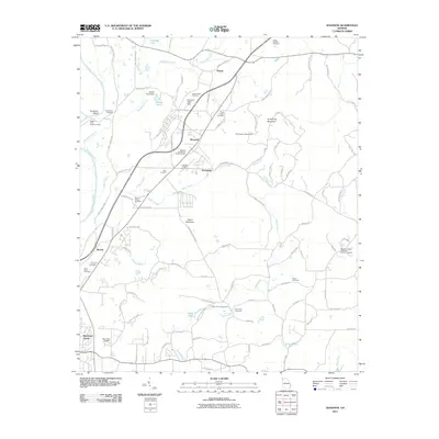
2011 Map of Shannon
USGS Topo · Published 2011About this map
Shannon and Hermitage anchor this Floyd County landscape, where the Oostanaula River creates a distinct loop at Troutman Bend. The area is characterized by a dense concentration of burial sites and rural landmarks, including the John Hume Cemetery and the Shannon Flight Strip. To the east, the terrain rises toward Armstrong Mountain, while the lowlands are defined by a network of waterways like Woodward Creek and Dykes Creek. Genealogists will find particular value in the numerous small family and community cemeteries such as Hasty Road Cemetery and Kerce Cemetery. The map also captures several local landmarks like the Hermitage Lookout Tower and the Morrison Campground, which, along with Halls Lake and Howell Lake, suggest a long-standing community structure centered around small settlements and agrarian land use.
Find a feature on this map
105 named features on this map. Tap any name to fly to it.
Don’t see what you’re looking for? This feature index may not catch every label — zoom into the map to look around manually.
Map Details
Editions of this 2011 Shannon Map
This is the sole edition of this map. No revisions or reprints were ever made.
Other maps of this area

1886 · Rome
USGS Topo · 1:125,000

1890 · Cartersville
USGS Topo · 1:125,000

1891 · Cartersville
USGS Topo · 1:125,000

1896 · Cartersville
USGS Topo · 1:125,000

1898 · Rome
USGS Topo · 1:125,000

1899 · Rome
USGS Topo · 1:125,000

1904 · Rome
USGS Topo · 1:125,000

1906 · Stilesboro
USGS Topo · 1:62,500

1908 · Stilesboro
USGS Topo · 1:62,500

1941 · Adairsville
USGS Topo · 1:62,500