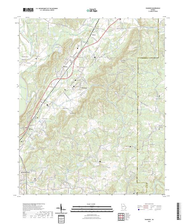
2024 Map of Shannon
USGS Topo · Published 2024About this map
The Oostanaula River carves a winding path through the western edge of this region, creating distinctive landmarks like Troutman Bend and the site of Pope Ferry. The landscape is defined by the transition from river bottomlands to the prominent heights of Ward Mountain and Armstrong Mountain. This area is characterized by numerous small rural communities and family-named landmarks, including the settlements of Shannon, Pinson, and Hermitage.
Find a feature on this map
162 named features on this map. Tap any name to fly to it.
Don’t see what you’re looking for? This feature index may not catch every label — zoom into the map to look around manually.
Map Details
Editions of this 2024 Shannon Map
This is the sole edition of this map. No revisions or reprints were ever made.
Other maps of this area

1886 · Rome
USGS Topo · 1:125,000

1890 · Cartersville
USGS Topo · 1:125,000

1891 · Cartersville
USGS Topo · 1:125,000

1896 · Cartersville
USGS Topo · 1:125,000

1898 · Rome
USGS Topo · 1:125,000

1899 · Rome
USGS Topo · 1:125,000

1904 · Rome
USGS Topo · 1:125,000

1906 · Stilesboro
USGS Topo · 1:62,500

1908 · Stilesboro
USGS Topo · 1:62,500

1941 · Adairsville
USGS Topo · 1:62,500