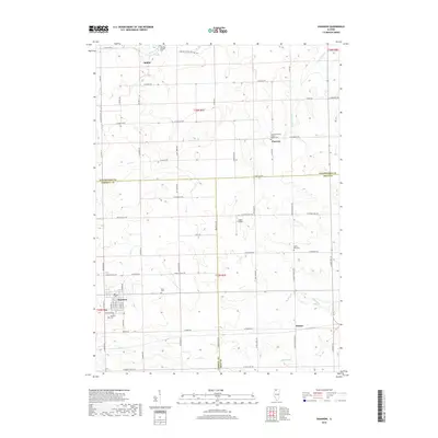
2018 Map of Shannon
USGS Topo · Published 2018About this map
Shannon serves as the primary hub of this agricultural landscape in Northern Illinois, situated near the intersection of the Stephenson, Carroll, and Ogle county lines. The area is defined by a dense network of country roads such as W Coffman Rd and Straw School Rd, which link several historic cemeteries including the Shell Cem and Prairie Dell Cem. These sites, along with the Lane Evangelical United Baptist Cem in Florence, provide significant touchpoints for genealogical research in the region. The terrain is drained by several small watercourses, most notably the Leaf River and Crane Grove Cr, which wind through the farmland. Small rural clusters like Harper and Bolton further illustrate the distribution of early settlements. A small private landing, Sneek Airport, marks a modern addition to this otherwise traditional rural layout.
Find a feature on this map
71 named features on this map. Tap any name to fly to it.
Don’t see what you’re looking for? This feature index may not catch every label — zoom into the map to look around manually.
Map Details
Editions of this 2018 Shannon Map
This is the sole edition of this map. No revisions or reprints were ever made.
Other maps of this area

1937 · Lena
USGS Topo · 1:48,000

1939 · Freeport
USGS Topo · 1:48,000

1942 · Mt Carroll
USGS Topo · 1:62,500

1942 · Lena
USGS Topo · 1:62,500

1942 · Forreston
USGS Topo · 1:62,500

1943 · Lena
USGS Topo · 1:62,500

1944 · Mt Carroll
USGS Topo · 1:62,500

1944 · Freeport
USGS Topo · 1:62,500

1945 · Forreston
USGS Topo · 1:62,500

1954 · Rockford
USGS Topo · 1:250,000