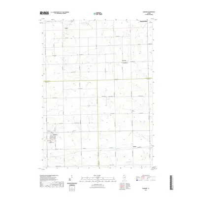
2021 Map of Shannon
USGS Topo · Published 2021About this map
Shannon and the surrounding agricultural lands of the Illinois prairie sit at the junction of Stephenson, Carroll, and Ogle counties in this 2021 study. The landscape is defined by its deep-rooted rural character, anchored by the village of Shannon and smaller settlements like Florence, Bolton, and Harper. A network of country roads, including Shannon Rte and Spring Valley Rd, connects the scattered farms and provides a clear view of the township's organization. For those tracing local heritage, the map is remarkably dense with cemeteries, including Shannon Brethren Cem, Shelly Cem, and Prairie Dell Cem, many of which are associated with historical churches such as the Lane Evangelical United Baptist Cem. Small watercourses like Lost Cr and Leaf River carve gentle drainages across the terrain, while landmarks like Sneek Airport reflect modern land use in this enduring farming region.
Find a feature on this map
70 named features on this map. Tap any name to fly to it.
Don’t see what you’re looking for? This feature index may not catch every label — zoom into the map to look around manually.
Map Details
Editions of this 2021 Shannon Map
This is the sole edition of this map. No revisions or reprints were ever made.
Other maps of this area

1937 · Lena
USGS Topo · 1:48,000

1939 · Freeport
USGS Topo · 1:48,000

1942 · Mt Carroll
USGS Topo · 1:62,500

1942 · Lena
USGS Topo · 1:62,500

1942 · Forreston
USGS Topo · 1:62,500

1943 · Lena
USGS Topo · 1:62,500

1944 · Mt Carroll
USGS Topo · 1:62,500

1944 · Freeport
USGS Topo · 1:62,500

1945 · Forreston
USGS Topo · 1:62,500

1954 · Rockford
USGS Topo · 1:250,000