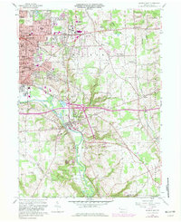
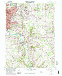
1958 Map of Sharon East
USGS Topo · Published 1981About this map
The Sharon industrial corridor and the growing suburban landscape of Hickory township are captured here during a period of mid-century transition. The map details the dense urban layout of Farrell and Wheatland along the Shenango River, where the rail infrastructure of the Penn Central line supported the region's manufacturing base. Beyond the city limits, the terrain rises toward Keel Ridge and Dutch Hill, showing the evolution of local landmarks like Buhl Park and numerous cemeteries including Oakwood Cem and Hillcrest Memorial Park.
Find a feature on this map
80 named features on this map. Tap any name to fly to it.
Don’t see what you’re looking for? This feature index may not catch every label — zoom into the map to look around manually.
Map Details
Editions of this 1958 Sharon East Map
5 editions found
Other maps of this area

1905 · Neshannock
USGS Topo · 1:62,500

1906 · Youngstown
USGS Topo · 1:62,500

1907 · Neshannock
USGS Topo · 1:62,500

1907 · Kinsman
USGS Topo · 1:62,500

1908 · Shenango
USGS Topo · 1:62,500

1908 · Youngstown
USGS Topo · 1:62,500

1950 · Cleveland
USGS Topo · 1:250,000

1951 · Campbell
USGS Topo · 1:24,000

1954 · Sharon West
USGS Topo · 1:24,000

1956 · Cleveland
USGS Topo · 1:250,000