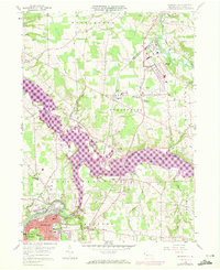
1958 Map of Sharpsville
USGS Topo · Published 1972About this map
The Shenango River Reservoir dominates this landscape, having significantly altered the valley floor between Sharpsville and Clark. While much of the terrain is characterized by the convergence of Pymatuning Creek and the Shenango River, the presence of extensive rail infrastructure like the Erie-Lackawanna and Penn Central lines underscores the region’s industrial connectivity. The 1970 photo-revisions highlight the suburban expansion of Reynolds Heights and Sharon, contrasted with rural landmarks such as Fell Cem and the Township Sch. Local genealogy is well-served by the clear marking of family-named spots like Lamonts Corners and Pritchards Corner. These updates, shown in purple, reveal the specific footprint of late-century development over the original mid-century topographic survey.
Find a feature on this map
50 named features on this map. Tap any name to fly to it.
Don’t see what you’re looking for? This feature index may not catch every label — zoom into the map to look around manually.
Map Details
Editions of this 1958 Sharpsville Map
5 editions found
Other maps of this area

1905 · Neshannock
USGS Topo · 1:62,500

1906 · Youngstown
USGS Topo · 1:62,500

1907 · Neshannock
USGS Topo · 1:62,500

1907 · Kinsman
USGS Topo · 1:62,500

1908 · Shenango
USGS Topo · 1:62,500

1908 · Youngstown
USGS Topo · 1:62,500

1950 · Cleveland
USGS Topo · 1:250,000

1954 · Sharon West
USGS Topo · 1:24,000

1956 · Cleveland
USGS Topo · 1:250,000

1958 · Sharpsville
USGS Topo · 1:24,000