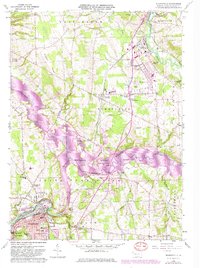
1958 Map of Sharpsville
USGS Topo · Published 1982About this map
Sharpsville and the Shenango River corridor define this western Pennsylvania landscape, which underwent significant change between the original 1958 survey and the late-1970s photogrammetric updates. The creation of Shenango River Lake transformed the valley, submerging portions of the riverbank near Clark and creating a new shoreline that reaches up toward Pymatuning. The rail-centered industrial character of the region is evident through the routes of Conrail and the Bessemer & Lake Erie railroads, which served the manufacturing and mining interests of Mercer County.
Find a feature on this map
55 named features on this map. Tap any name to fly to it.
Don’t see what you’re looking for? This feature index may not catch every label — zoom into the map to look around manually.
Map Details
Editions of this 1958 Sharpsville Map
5 editions found
Other maps of this area

1905 · Neshannock
USGS Topo · 1:62,500

1906 · Youngstown
USGS Topo · 1:62,500

1907 · Neshannock
USGS Topo · 1:62,500

1907 · Kinsman
USGS Topo · 1:62,500

1908 · Shenango
USGS Topo · 1:62,500

1908 · Youngstown
USGS Topo · 1:62,500

1950 · Cleveland
USGS Topo · 1:250,000

1954 · Sharon West
USGS Topo · 1:24,000

1956 · Cleveland
USGS Topo · 1:250,000

1958 · Sharpsville
USGS Topo · 1:24,000