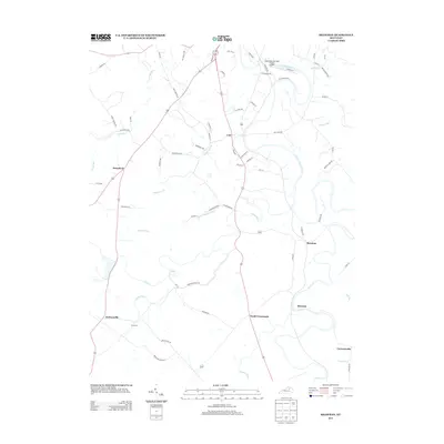
2013 Map of Shawhan
USGS Topo · Published 2013About this map
The S Fork Licking River winds through this central Kentucky landscape, defining a region where small unincorporated settlements like Shawhan and Lair sit at the crossroads of old turnpikes and rural lanes. The area's agricultural character is evidenced by the density of family-named roads and routes like Grays Run Pike and Edgewater Pike, which connect long-standing communities such as Broadwell and Ewalt Crossroads.
Find a feature on this map
71 named features on this map. Tap any name to fly to it.
Don’t see what you’re looking for? This feature index may not catch every label — zoom into the map to look around manually.
Map Details
Editions of this 2013 Shawhan Map
This is the sole edition of this map. No revisions or reprints were ever made.
Other maps of this area

1927 · Lexington
USGS Topo · 1:48,000

1929 · Cynthiana
USGS Topo · 1:48,000

1929 · Lexington
USGS Topo · 1:62,500

1934 · Cynthiana
USGS Topo · 1:62,500

1952 · Paris East
USGS Topo · 1:24,000

1952 · Shady Nook
USGS Topo · 1:24,000

1953 · Millersburg
USGS Topo · 1:24,000

1953 · Breckinridge
USGS Topo · 1:24,000
1953 · Cynthiana
USGS Topo · 1:24,000
1954 · Shawhan
USGS Topo · 1:24,000