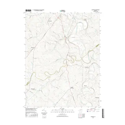
2016 Map of Shawhan
USGS Topo · Published 2016About this map
Cynthiana anchors the northern reaches of this Bluegrass region landscape, where the South Fork Licking River meanders toward the town center. The 2016 terrain is defined by a dense network of pikes and lanes connecting small rural settlements like Lair, Shawhan, and Ewalt Crossroads. This period shows the modern infrastructure of the Cynthiana-Harrison County Airport alongside much older landmarks such as Smith Cem.
Find a feature on this map
56 named features on this map. Tap any name to fly to it.
Don’t see what you’re looking for? This feature index may not catch every label — zoom into the map to look around manually.
Map Details
Editions of this 2016 Shawhan Map
This is the sole edition of this map. No revisions or reprints were ever made.
Other maps of this area

1927 · Lexington
USGS Topo · 1:48,000

1929 · Cynthiana
USGS Topo · 1:48,000

1929 · Lexington
USGS Topo · 1:62,500

1934 · Cynthiana
USGS Topo · 1:62,500

1952 · Paris East
USGS Topo · 1:24,000

1952 · Shady Nook
USGS Topo · 1:24,000

1953 · Millersburg
USGS Topo · 1:24,000

1953 · Breckinridge
USGS Topo · 1:24,000
1953 · Cynthiana
USGS Topo · 1:24,000
1954 · Shawhan
USGS Topo · 1:24,000