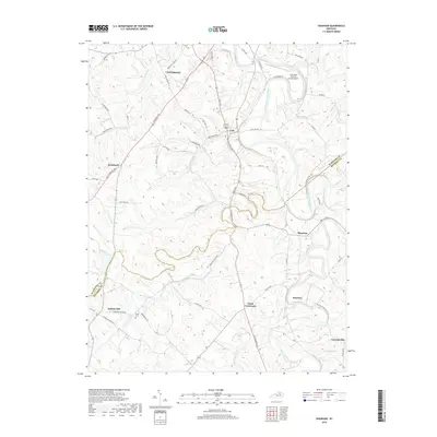
2019 Map of Shawhan
USGS Topo · Published 2019About this map
The South Fork Licking River carves a winding path through this central Kentucky landscape, serving as a primary geographic anchor for the region's rural character. In the northern reaches of the map, the city of Cynthiana marks a significant center of habitation, while smaller communities such as Lair, Shawhan, and Broadwell are dispersed along the road network. The topography is defined by numerous drainage systems, including Huskens Run, Townsend Creek, and Silas Creek, which dictate the placement of local pikes and farmsteads.
Find a feature on this map
57 named features on this map. Tap any name to fly to it.
Don’t see what you’re looking for? This feature index may not catch every label — zoom into the map to look around manually.
Map Details
Editions of this 2019 Shawhan Map
This is the sole edition of this map. No revisions or reprints were ever made.
Other maps of this area

1927 · Lexington
USGS Topo · 1:48,000

1929 · Cynthiana
USGS Topo · 1:48,000

1929 · Lexington
USGS Topo · 1:62,500

1934 · Cynthiana
USGS Topo · 1:62,500

1952 · Paris East
USGS Topo · 1:24,000

1952 · Shady Nook
USGS Topo · 1:24,000

1953 · Millersburg
USGS Topo · 1:24,000

1953 · Breckinridge
USGS Topo · 1:24,000
1953 · Cynthiana
USGS Topo · 1:24,000
1954 · Shawhan
USGS Topo · 1:24,000