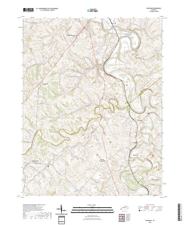
2022 Map of Shawhan
USGS Topo · Published 2022About this map
Cynthiana and the surrounding agricultural landscape define this portion of the Bluegrass region where the Harrison Co Bourbon Co line follows the meandering path of Townsend Creek. The topography is marked by the deep incisions of the South Fork Licking River and its tributaries, such as Huskens Run and Grays Run, which carve through the limestone-rich soil. Small crossroads communities like Broadwell and Lair are connected by historic pikes, including the Leesburg Pike and Paris Pike, reflecting a transport network built for moving livestock and crops to market. Near the southern edge of the map, the confluence of Stoner Creek and South Fork Licking River anchors the settlement of Shawhan. The inclusion of the Smith Cem and established family-named landmarks like Kiserton provides critical data points for researchers tracing the 19th-century landholdings that persisted into the modern era.
Find a feature on this map
72 named features on this map. Tap any name to fly to it.
Don’t see what you’re looking for? This feature index may not catch every label — zoom into the map to look around manually.
Map Details
Editions of this 2022 Shawhan Map
This is the sole edition of this map. No revisions or reprints were ever made.
Other maps of this area

1927 · Lexington
USGS Topo · 1:48,000

1929 · Cynthiana
USGS Topo · 1:48,000

1929 · Lexington
USGS Topo · 1:62,500

1934 · Cynthiana
USGS Topo · 1:62,500

1952 · Paris East
USGS Topo · 1:24,000

1952 · Shady Nook
USGS Topo · 1:24,000

1953 · Millersburg
USGS Topo · 1:24,000

1953 · Breckinridge
USGS Topo · 1:24,000
1953 · Cynthiana
USGS Topo · 1:24,000
1954 · Shawhan
USGS Topo · 1:24,000