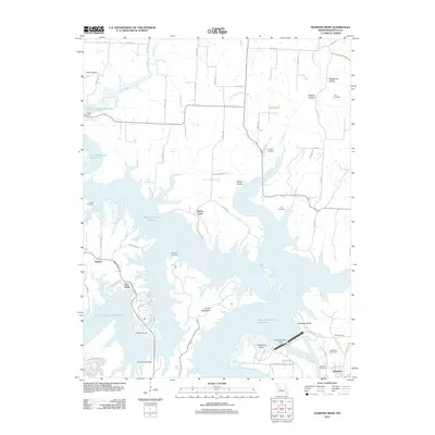
2011 Map of Shawnee Bend
USGS Topo · Published 2011About this map
Harry S Truman Reservoir dominates this landscape in Benton County, illustrating the significant hydrological transformation of the Osage River valley. The massive reservoir surrounds prominent landforms like Kaysinger Bluff and the narrow ridge known as Devils Backbone. Near the Harry S Truman Dam, the city of Warsaw serves as a focal point for the region, while smaller settlements such as Racket and Macks Camp represent the recreational and residential communities that have developed along the shoreline.
Find a feature on this map
59 named features on this map. Tap any name to fly to it.
Don’t see what you’re looking for? This feature index may not catch every label — zoom into the map to look around manually.
Map Details
Editions of this 2011 Shawnee Bend Map
This is the sole edition of this map. No revisions or reprints were ever made.
Other maps of this area

1887 · Clinton
USGS Topo · 1:125,000

1887 · Warsaw
USGS Topo · 1:125,000

1894 · Warsaw
USGS Topo · 1:125,000

1894 · Clinton
USGS Topo · 1:125,000

1935 · Dell
USGS Topo · 1:24,000

1936 · Shawnee Bend
USGS Topo · 1:24,000

1936 · Schuyler
USGS Topo · 1:24,000

1941 · Valhalla
USGS Topo · 1:24,000

1945 · Fristoe
USGS Topo · 1:62,500
1945 · Valhalla
USGS Topo · 1:24,000