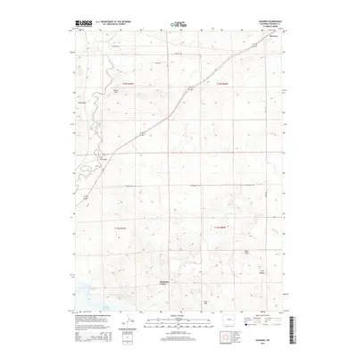
2015 Map of Shawnee
USGS Topo · Published 2015About this map
The high plains of Converse County are defined by the convergence of drainage systems and the small settlement of Shawnee. This portion of Wyoming reveals a landscape shaped by water and elevation, where the E Fork Shawnee Cr and Shawnee Cr carve through the terrain. To the south, the waters of the Glendo Reservoir reach into the quadrangle near the intersection of several localized landmarks.
Find a feature on this map
22 named features on this map. Tap any name to fly to it.
Don’t see what you’re looking for? This feature index may not catch every label — zoom into the map to look around manually.
Map Details
Editions of this 2015 Shawnee Map
This is the sole edition of this map. No revisions or reprints were ever made.
Other maps of this area

1949 · Shawnee
USGS Topo · 1:24,000

1949 · Cedar Hill
USGS Topo · 1:24,000

1949 · Orin
USGS Topo · 1:24,000

1950 · Glendo
USGS Topo · 1:24,000

1950 · Amend Ranch
USGS Topo · 1:24,000

1950 · Orin
USGS Topo · 1:24,000

1950 · Shawnee
USGS Topo · 1:24,000

1950 · Jewel Springs
USGS Topo · 1:24,000
1951 · Cedar Hill
USGS Topo · 1:24,000

1954 · Torrington
USGS Topo · 1:250,000