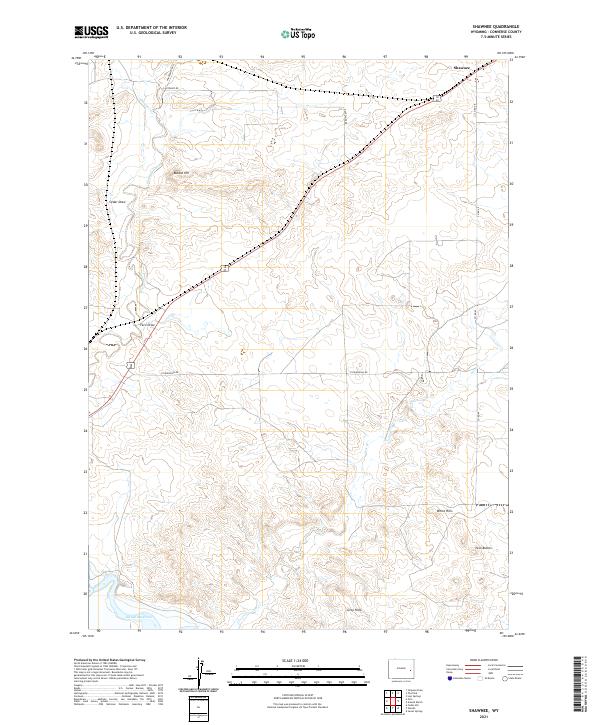
2021 Map of Shawnee
USGS Topo · Published 2021About this map
High plains terrain and water management define this portion of Converse County, Wyoming. The northeastern corner is anchored by the small settlement of Shawnee, while the southern reaches of the map show the expansive waters of Glendo Reservoir. The landscape is characterized by its drainage patterns and distinct topographical rises, including the White Hills and Twin Buttes in the southeast. Ephemeral waterways like Shawnee Creek and Lost Cr carve through the land, alongside named depressions such as Cedar Draw and Fero Draw. This survey captures a rural landscape where local infrastructure like Pickinpaugh Rd and Co Rd 49 connects remote homesteads and ranching allotments across the township lines of the t32n r69w and t31n r68w survey grids.
Find a feature on this map
19 named features on this map. Tap any name to fly to it.
Don’t see what you’re looking for? This feature index may not catch every label — zoom into the map to look around manually.
Map Details
Editions of this 2021 Shawnee Map
This is the sole edition of this map. No revisions or reprints were ever made.
Other maps of this area

1949 · Shawnee
USGS Topo · 1:24,000

1949 · Cedar Hill
USGS Topo · 1:24,000

1949 · Orin
USGS Topo · 1:24,000

1950 · Glendo
USGS Topo · 1:24,000

1950 · Amend Ranch
USGS Topo · 1:24,000

1950 · Orin
USGS Topo · 1:24,000

1950 · Shawnee
USGS Topo · 1:24,000

1950 · Jewel Springs
USGS Topo · 1:24,000
1951 · Cedar Hill
USGS Topo · 1:24,000

1954 · Torrington
USGS Topo · 1:250,000