
1949 Map of Shawnee
USGS Topo · Published 1958About this map
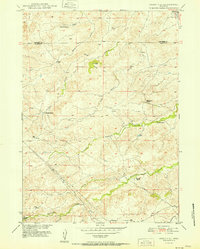
Shawnee serves as a focal point in the northeast corner of this Converse County landscape, situated along the line of the Chicago and Northwestern railroad. The topography is defined by the drainage patterns of Shawnee Creek and Lost Creek, which wind through the plains toward the North Platte River at the southern edge of the sheet. This 1949 survey, conducted as part of the Missouri River Basin development program, shows a sparsely populated ranching region punctuated by small rail-side settlements like Fisher. The placement of the local Cem near Shawnee and numerous windmills across the rangeland underscores the self-sufficient nature of these early Wyoming communities. The transition from the high prairie to the river valley bottom is clearly marked, illustrating the vital role of water access in an otherwise arid environment.
Find a feature on this map
8 named features on this map. Tap any name to fly to it.
Don’t see what you’re looking for? This feature index may not catch every label — zoom into the map to look around manually.
Map Details
Editions of this 1949 Shawnee Map
This is the sole edition of this map. No revisions or reprints were ever made.
Other maps of this area

1949 · Cedar Hill
USGS Topo · 1:24,000

1949 · Orin
USGS Topo · 1:24,000

1950 · Glendo
USGS Topo · 1:24,000

1950 · Amend Ranch
USGS Topo · 1:24,000

1950 · Orin
USGS Topo · 1:24,000

1950 · Shawnee
USGS Topo · 1:24,000

1950 · Jewel Springs
USGS Topo · 1:24,000
1951 · Cedar Hill
USGS Topo · 1:24,000

1954 · Torrington
USGS Topo · 1:250,000

1958 · Torrington
USGS Topo · 1:250,000