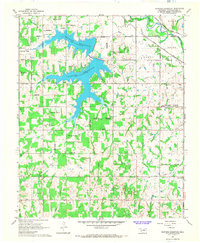
1966 Map of Shawnee Reservoir
USGS Topo · Published 1968About this map
Shawnee Reservoir dominates the landscape of western Pottawatomie County, its many fingers reaching into the surrounding townships of Bales and Brinton. This 1960s survey documents a rural region defined by its watercourses and early infrastructure, from the North Canadian River in the northeast to the various creeks like South Deer Creek and Squirrel Creek that feed the local drainage. The map reveals a community-focused geography, marked by numerous small landmarks that served as local anchors.
Find a feature on this map
33 named features on this map. Tap any name to fly to it.
Don’t see what you’re looking for? This feature index may not catch every label — zoom into the map to look around manually.
Map Details
Editions of this 1966 Shawnee Reservoir Map
3 editions found
Other maps of this area

1896 · Seminole and Prague
USGS Topo · 1:125,000

1898 · Purcell
USGS Topo · 1:125,000

1907 · Maud
USGS Topo · 1:62,500

1908 · Maud
USGS Topo · 1:62,500

1909 · Shawnee
USGS Topo · 1:62,500

1910 · McComb
USGS Topo · 1:62,500

1930 · McLoud
USGS Topo · 1:62,500

1954 · Oklahoma City
USGS Topo · 1:250,000

1956 · Harrah
USGS Topo · 1:24,000
1956 · Stella
USGS Topo · 1:24,000