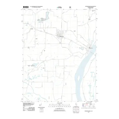
2010 Map of Shawneetown
USGS Topo · Published 2010About this map
Old Shawneetown and its modern counterpart Shawneetown highlight a landscape deeply defined by the shifting course and power of the Ohio River. This area of Gallatin County shows the physical distance between the historic riverfront settlement and the newer town site to the west, linked by Hwy 13. The topography transitions from the low-lying Kuykendall Valley to the prominent heights of Gold Hill and the Shawneetown Hills, providing a clear view of how terrain dictated the settlement patterns of this river-and-rail corridor. Genealogists will find several family and church burial grounds across the quadrangle, including the Immaculate Conception Cemetery and Kanady Cemetery. To the south, the Saline River winds toward its confluence, while numerous named water bodies like Dixon Pond and State Lake dot the wetlands near the state border. This survey effectively documents the intersection of modern road networks with the enduring water-shaped geography of southeastern Illinois.
Find a feature on this map
59 named features on this map. Tap any name to fly to it.
Don’t see what you’re looking for? This feature index may not catch every label — zoom into the map to look around manually.
Map Details
Editions of this 2010 Shawneetown Map
This is the sole edition of this map. No revisions or reprints were ever made.
Other maps of this area

1905 · Eldorado
USGS Topo · 1:62,500

1905 · New Haven
USGS Topo · 1:62,500

1906 · New Haven
USGS Topo · 1:62,500

1906 · Eldorado
USGS Topo · 1:62,500

1916 · Shawneetown
USGS Topo · 1:62,500

1916 · Equality
USGS Topo · 1:62,500

1949 · Paducah
USGS Topo · 1:250,000

1949 · New Haven
USGS Topo · 1:62,500

1950 · Paducah
USGS Topo · 1:250,000
1953 · Wabash Island
USGS Topo · 1:24,000