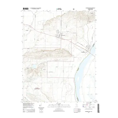
2015 Map of Shawneetown
USGS Topo · Published 2015About this map
Old Shawneetown sits on the banks of the Ohio River, marking a location deeply tied to early Illinois river commerce and the shifting geography of the valley. Following devastating floods in the 20th century, much of the population moved to the newer site of Shawneetown located on higher ground to the northwest. This transition is visible through the infrastructure connecting the two sites, including Old Highway 13 and CR-15.
Find a feature on this map
69 named features on this map. Tap any name to fly to it.
Don’t see what you’re looking for? This feature index may not catch every label — zoom into the map to look around manually.
Map Details
Editions of this 2015 Shawneetown Map
This is the sole edition of this map. No revisions or reprints were ever made.
Other maps of this area

1905 · Eldorado
USGS Topo · 1:62,500

1905 · New Haven
USGS Topo · 1:62,500

1906 · New Haven
USGS Topo · 1:62,500

1906 · Eldorado
USGS Topo · 1:62,500

1916 · Shawneetown
USGS Topo · 1:62,500

1916 · Equality
USGS Topo · 1:62,500

1949 · Paducah
USGS Topo · 1:250,000

1949 · New Haven
USGS Topo · 1:62,500

1950 · Paducah
USGS Topo · 1:250,000
1953 · Wabash Island
USGS Topo · 1:24,000