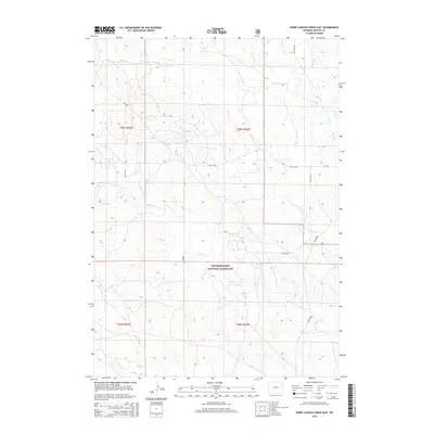
2015 Map of Sheep Canyon Creek East
USGS Topo · Published 2015About this map
The high plains of Thunder Basin National Grassland dominate this portion of Weston County, where a complex network of seasonal drainages and ranch roads defines the landscape. The geography is characterized by the branching waters of Fiddler Creek and Sheep Canyon Creek, which feed into larger systems like Beaver Creek. Human infrastructure is light but persistent, marked by essential water management features such as Minter Reservoir and a grid of access routes including Oil City Road and Butcher Road. This 2015 U.S. Geological Survey representation provides a clear view of the modern land management boundaries within the public grasslands, documenting the intersection of natural watersheds like Spoon Creek and Mush Creek with the enduring section lines of the Public Land Survey System.
Find a feature on this map
22 named features on this map. Tap any name to fly to it.
Don’t see what you’re looking for? This feature index may not catch every label — zoom into the map to look around manually.
Map Details
Editions of this 2015 Sheep Canyon Creek East Map
This is the sole edition of this map. No revisions or reprints were ever made.
Other maps of this area

1898 · Sundance
USGS Topo · 1:125,000

1899 · Newcastle
USGS Topo · 1:125,000

1901 · Newcastle
USGS Topo · 1:125,000

1902 · Sundance
USGS Topo · 1:125,000

1918 · Moorcroft
USGS Topo · 1:125,000

1954 · Gillette
USGS Topo · 1:250,000

1955 · Newcastle
USGS Topo · 1:250,000

1955 · Gillette
USGS Topo · 1:250,000

1957 · Upton
USGS Topo · 1:62,500

1958 · Gillette
USGS Topo · 1:250,000