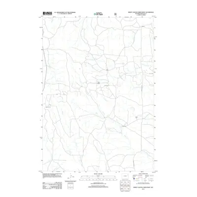
2012 Map of Sheep Canyon Creek West
USGS Topo · Published 2012About this map
The Fiddler Creek Oil Field centers this landscape in eastern Wyoming, illustrating the intersection of energy extraction and traditional ranching at the start of the 20th century's second decade. A network of drainage systems, including the W Fork Fiddler Cr and N Fork Mush Cr, carves through the terrain, dictating the placement of historic homesteads. These family-named properties, such as Kraft Ranch, Childs Ranch, and Peterson Ranch, are connected by a sparse grid of rural arteries like Upton Fairview Rd and Oil City Rd. The map also documents vital water sources in this arid environment, specifically Mud Springs and the headwaters of Sheep Canyon Cr, which have historically served as the lifelines for local agriculture and settlement patterns.
Find a feature on this map
19 named features on this map. Tap any name to fly to it.
Don’t see what you’re looking for? This feature index may not catch every label — zoom into the map to look around manually.
Map Details
Editions of this 2012 Sheep Canyon Creek West Map
This is the sole edition of this map. No revisions or reprints were ever made.
Other maps of this area

1918 · Moorcroft
USGS Topo · 1:125,000

1954 · Gillette
USGS Topo · 1:250,000

1955 · Newcastle
USGS Topo · 1:250,000

1955 · Gillette
USGS Topo · 1:250,000

1957 · Upton
USGS Topo · 1:62,500

1958 · Gillette
USGS Topo · 1:250,000

1958 · Newcastle
USGS Topo · 1:250,000

1962 · Gillette
USGS Topo · 1:250,000

1979 · Newcastle
USGS Topo · 1:100,000

1979 · Sundance
USGS Topo · 1:100,000