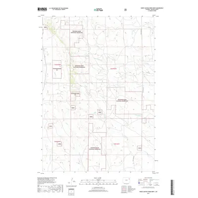
2017 Map of Sheep Canyon Creek West
USGS Topo · Published 2017About this map
Thunder Basin National Grassland dominates this portion of Weston County, where a complex network of seasonal drainages carves through the high plains. The landscape is defined by the headwaters and branches of several significant local creeks, including the westward-flowing W Fork Fiddler Cr and the diverging paths of Mush Cr and the N Fork Mush Cr. These waterways reflect the characteristic drainage patterns of the Powder River Basin, often centering around vital water points like Mud Springs. Remote ranching and energy access are evident through the placement of secondary routes such as Upton Fairview Rd and Oil City Rd, which navigate the township and range divisions of this expansive public land. The map provides a clear look at the jurisdictional boundaries between national grassland and private holdings in this sparsely populated region of northeast Wyoming.
Find a feature on this map
19 named features on this map. Tap any name to fly to it.
Don’t see what you’re looking for? This feature index may not catch every label — zoom into the map to look around manually.
Map Details
Editions of this 2017 Sheep Canyon Creek West Map
This is the sole edition of this map. No revisions or reprints were ever made.
Other maps of this area

1918 · Moorcroft
USGS Topo · 1:125,000

1954 · Gillette
USGS Topo · 1:250,000

1955 · Newcastle
USGS Topo · 1:250,000

1955 · Gillette
USGS Topo · 1:250,000

1957 · Upton
USGS Topo · 1:62,500

1958 · Gillette
USGS Topo · 1:250,000

1958 · Newcastle
USGS Topo · 1:250,000

1962 · Gillette
USGS Topo · 1:250,000

1979 · Newcastle
USGS Topo · 1:100,000

1979 · Sundance
USGS Topo · 1:100,000