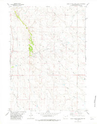
1982 Map of Sheep Canyon Creek West
USGS Topo · Published 1982About this map
The Fiddler Creek Oil Field dominates this section of Weston County, showing a landscape defined by industrial development and intermittent drainage. Numerous Oil Wells are scattered across the plains, particularly concentrated around the fork of Fiddler Creek and Mush Creek. The terrain is etched by complex drainage systems including Sheep Canyon Creek, Buffalo Creek, and the headwaters of E Fk Hay Creek. Evidence of supporting infrastructure is visible near the center of the field at the Substa and along various pipelines. This 1980s-era survey documents the intersection of energy extraction and the natural topography of the Wyoming grasslands, where the North Fork Mush Creek and Deep Creek provide the primary geographic relief amidst a network of service roads and well pads.
Find a feature on this map
10 named features on this map. Tap any name to fly to it.
Don’t see what you’re looking for? This feature index may not catch every label — zoom into the map to look around manually.
Map Details
Editions of this 1982 Sheep Canyon Creek West Map
This is the sole edition of this map. No revisions or reprints were ever made.
Other maps of this area

1918 · Moorcroft
USGS Topo · 1:125,000

1954 · Gillette
USGS Topo · 1:250,000

1955 · Newcastle
USGS Topo · 1:250,000

1955 · Gillette
USGS Topo · 1:250,000

1957 · Upton
USGS Topo · 1:62,500

1958 · Gillette
USGS Topo · 1:250,000

1958 · Newcastle
USGS Topo · 1:250,000

1962 · Gillette
USGS Topo · 1:250,000

1979 · Newcastle
USGS Topo · 1:100,000

1979 · Sundance
USGS Topo · 1:100,000