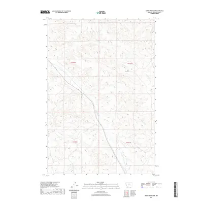
2020 Map of Sheep Creek Camp
USGS Topo · Published 2020About this map
Sheep Creek Camp sits within the dissected plateaus of Rosebud County, serving as a focal point for this rural Montana landscape. The area is defined by a dense network of seasonal drainages, including the headwaters and tributaries of E Fork Armells Cr and Cottonwood Cr. These creek beds have carved deep relief into the terrain, creating a complex series of ridges and draws that dictate the movement of local traffic and livestock.
Find a feature on this map
10 named features on this map. Tap any name to fly to it.
Don’t see what you’re looking for? This feature index may not catch every label — zoom into the map to look around manually.
Map Details
Editions of this 2020 Sheep Creek Camp Map
This is the sole edition of this map. No revisions or reprints were ever made.
Other maps of this area

1954 · Hardin
USGS Topo · 1:250,000

1954 · Forsyth
USGS Topo · 1:250,000

1957 · Hardin
USGS Topo · 1:250,000

1957 · Forsyth
USGS Topo · 1:250,000

1958 · Forsyth
USGS Topo · 1:250,000

1958 · Hardin
USGS Topo · 1:250,000

1971 · Trail Creek School
USGS Topo · 1:24,000

1971 · Colstrip East
USGS Topo · 1:24,000

1971 · Griffin Coulee NE
USGS Topo · 1:24,000

1971 · Smith Creek NE
USGS Topo · 1:24,000