
1971 Map of Colstrip East
USGS Topo · Published 1974About this map
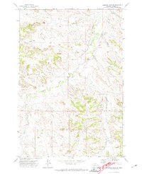
Colstrip serves as the industrial heart of this landscape in the early 1970s, where the expansion of coal extraction is clearly visible. The massive Strip Mine footprint and associated Mine workings dominate the southwestern terrain, served by the Burlington Northern railroad lines that snake through the valley to transport coal. This industrial activity contrasts with the surrounding topography, which is defined by a series of drainages including Sprague Creek, Spring Creek, and Pony Creek.
Find a feature on this map
19 named features on this map. Tap any name to fly to it.
Don’t see what you’re looking for? This feature index may not catch every label — zoom into the map to look around manually.
Map Details
Editions of this 1971 Colstrip East Map
This is the sole edition of this map. No revisions or reprints were ever made.
Other maps of this area

1954 · Hardin
USGS Topo · 1:250,000

1954 · Forsyth
USGS Topo · 1:250,000

1957 · Hardin
USGS Topo · 1:250,000

1957 · Forsyth
USGS Topo · 1:250,000

1958 · Forsyth
USGS Topo · 1:250,000

1958 · Hardin
USGS Topo · 1:250,000

1971 · Colstrip SW
USGS Topo · 1:24,000

1971 · Colstrip SE
USGS Topo · 1:24,000

1971 · Hammond Draw NW
USGS Topo · 1:24,000
1971 · Hammond Draw SW
USGS Topo · 1:24,000