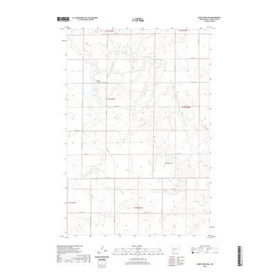
2020 Map of Sheep Creek Dam
USGS Topo · Published 2020About this map
The Cannonball River meanders across this Grant County landscape, carving a distinct path through the North Dakota plains. This 2020 map documents the rural character of the region, where wide-open sections of land are defined by the Public Land Survey System grids of T133N and T134N. A notable landmark, Medicine Rock, stands out as a prominent natural feature near the southern reaches of the river, offering a specific point of interest for those studying the local topography.
Find a feature on this map
25 named features on this map. Tap any name to fly to it.
Don’t see what you’re looking for? This feature index may not catch every label — zoom into the map to look around manually.
Map Details
Editions of this 2020 Sheep Creek Dam Map
This is the sole edition of this map. No revisions or reprints were ever made.
Other maps of this area

1954 · Bismarck
USGS Topo · 1:250,000

1958 · Bismarck
USGS Topo · 1:250,000

1972 · Leith
USGS Topo · 1:24,000

1972 · Wheeler Hills
USGS Topo · 1:24,000

1972 · Coffin Buttes
USGS Topo · 1:24,000

1972 · New Leipzig South
USGS Topo · 1:24,000

1972 · Pretty Rock Butte
USGS Topo · 1:24,000

1972 · Sheep Creek Dam
USGS Topo · 1:24,000

1980 · Heil
USGS Topo · 1:24,000
1980 · Elgin
USGS Topo · 1:24,000