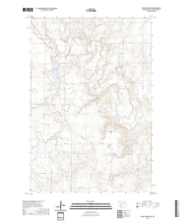
2024 Map of Sheep Creek Dam
USGS Topo · Published 2024About this map
The Cannonball River meanders across this rural section of Grant County, joined by the winding course of Sheep Creek. This landscape is defined by the persistent survey grid of the Public Land Survey System, with township and range lines marking the transition between t133n r89w and neighboring tracts. A notable natural landmark, Medicine Rock, stands as a significant point of interest in the southern half of the map. The area is intersected by a network of sectional roads, including the prominent Elgin Rd and various routes like 72nd St Sw and 80th St Sw, which facilitate movement through the open prairie and river valleys of North Dakota.
Find a feature on this map
23 named features on this map. Tap any name to fly to it.
Don’t see what you’re looking for? This feature index may not catch every label — zoom into the map to look around manually.
Map Details
Editions of this 2024 Sheep Creek Dam Map
This is the sole edition of this map. No revisions or reprints were ever made.
Other maps of this area

1954 · Bismarck
USGS Topo · 1:250,000

1958 · Bismarck
USGS Topo · 1:250,000

1972 · Leith
USGS Topo · 1:24,000

1972 · Wheeler Hills
USGS Topo · 1:24,000

1972 · Coffin Buttes
USGS Topo · 1:24,000

1972 · New Leipzig South
USGS Topo · 1:24,000

1972 · Pretty Rock Butte
USGS Topo · 1:24,000

1972 · Sheep Creek Dam
USGS Topo · 1:24,000

1980 · Heil
USGS Topo · 1:24,000
1980 · Elgin
USGS Topo · 1:24,000