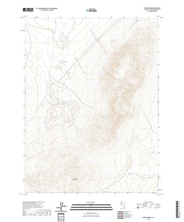
2021 Map of Sheep Spring
USGS Topo · Published 2021About this map
Sheephead Mountains define the southern reaches of this Pershing County landscape, where the terrain rises sharply from the surrounding basins. This 2021 topographic record of the high desert environment highlights the critical role of sparse water sources in an arid climate. Centrally located within the topography, Sheep Spring provides a named landmark and likely historical watering point for local livestock or wildlife. In the northwestern sector, the drainage of Lava Beds Cr cuts through the flats, illustrating the seasonal water patterns that shape the regional hydrology. The map's grid-work of township and range lines, such as t33n r27e, provides the primary structure for land management in this sparsely settled portion of Nevada, where vast stretches of open land remain largely undeveloped except for rudimentary 4WD tracks and local roads.
Find a feature on this map
7 named features on this map. Tap any name to fly to it.
Don’t see what you’re looking for? This feature index may not catch every label — zoom into the map to look around manually.
Map Details
Editions of this 2021 Sheep Spring Map
This is the sole edition of this map. No revisions or reprints were ever made.
Other maps of this area

1886 · Granite Range
USGS Topo · 1:250,000

1894 · Granite Range
USGS Topo · 1:250,000

1931 · Lovelock
USGS Topo · 1:250,000

1935 · Lovelock
USGS Topo · 1:250,000

1955 · Lovelock
USGS Topo · 1:250,000

1959 · Lovelock
USGS Topo · 1:250,000

1980 · Eagle Rock Spring
USGS Topo · 1:24,000
1980 · Trego Hot Spring
USGS Topo · 1:24,000

1980 · Dry Mountain
USGS Topo · 1:24,000
1981 · Sheep Spring
USGS Topo · 1:24,000