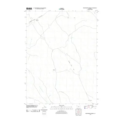
2010 Map of Sheepherder Springs
USGS Topo · Published 2010About this map
Vermillion Bluffs dominate the northwestern horizon of this Moffat County landscape, where the high-desert terrain is carved by complex drainage systems and intermittent water sources. This 2010 topographic record captures a sparsely populated region of northwestern Colorado defined more by its geology than its settlements. The Vermillion Cliffs Mine stands as a primary point of human industry amidst a network of primitive roads, including County Rd 128 and County Rd 67. Strategic water points like Sheepherder Spring and the nearby Sheepherder Springs Draw highlight the essential nature of water management in this arid environment. Significant natural landmarks such as Lookout Mountain and Twin Buttes provide vertical relief, while the North Fork Sand Wash and Lake Draw illustrate the seasonal flow patterns that shape the local basins. This survey serves as a precise guide to the remote physical features and limited infrastructure of the Colorado high country at the turn of the decade.
Find a feature on this map
13 named features on this map. Tap any name to fly to it.
Don’t see what you’re looking for? This feature index may not catch every label — zoom into the map to look around manually.
Map Details
Editions of this 2010 Sheepherder Springs Map
This is the sole edition of this map. No revisions or reprints were ever made.
Other maps of this area

1954 · Vernal
USGS Topo · 1:250,000

1958 · Vernal
USGS Topo · 1:250,000

1960 · Vernal
USGS Topo · 1:250,000

1960 · Lone Mountain
USGS Topo · 1:62,500

1966 · G Spring
USGS Topo · 1:24,000

1966 · Sheephead Basin
USGS Topo · 1:24,000

1966 · Hiawatha
USGS Topo · 1:24,000

1969 · Sheepherder Springs
USGS Topo · 1:24,000

1969 · Coffeepot Spring
USGS Topo · 1:24,000

1969 · Powder Wash
USGS Topo · 1:24,000