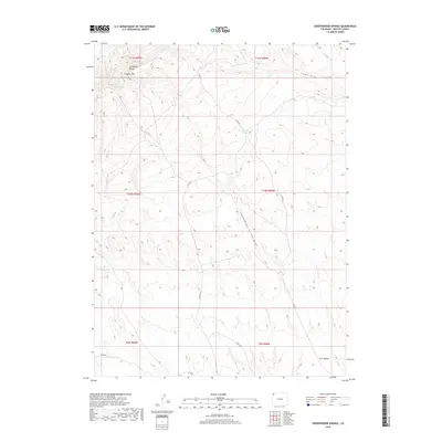
2019 Map of Sheepherder Springs
USGS Topo · Published 2019About this map
Vermillion Bluffs and the prominent peak of Lookout Mtn define the northern reaches of this Colorado landscape, where drainage patterns dictate the movement of both water and travelers. The territory is marked by deep geographic depressions including Lake Draw and the extensive Sheepherder Springs Draw, which flows southward from the eponymous Sheepherder Springs. This high-desert terrain in Moffat County shows a network of remote corridors such as Co RD 67 and Co RD 52 that weave between topographical landmarks like Twin Buttes. The placement of these roads relative to the springs suggests the continued importance of reliable water sources for land management and movement through this arid portion of the American West.
Find a feature on this map
16 named features on this map. Tap any name to fly to it.
Don’t see what you’re looking for? This feature index may not catch every label — zoom into the map to look around manually.
Map Details
Editions of this 2019 Sheepherder Springs Map
This is the sole edition of this map. No revisions or reprints were ever made.
Other maps of this area

1954 · Vernal
USGS Topo · 1:250,000

1958 · Vernal
USGS Topo · 1:250,000

1960 · Vernal
USGS Topo · 1:250,000

1960 · Lone Mountain
USGS Topo · 1:62,500

1966 · G Spring
USGS Topo · 1:24,000

1966 · Sheephead Basin
USGS Topo · 1:24,000

1966 · Hiawatha
USGS Topo · 1:24,000

1969 · Sheepherder Springs
USGS Topo · 1:24,000

1969 · Coffeepot Spring
USGS Topo · 1:24,000

1969 · Powder Wash
USGS Topo · 1:24,000