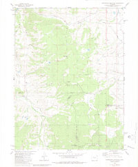
1980 Map of Sheephorn Mountain
USGS Topo · Published 1980About this map
White River National Forest and Arapaho National Forest meet at a high-elevation triple point where Grand, Eagle, and Summit counties converge. This 1980 survey reveals a landscape defined by sharp elevation changes between Sheephorn Mountain and the water sources of the Colorado River Jeep Trail and Sheephorn Creek. The inclusion of the Sheephorn Cem provides a specific point of interest for genealogists investigating early families in this part of the Colorado high country. Human modification of the drainage patterns is evident in the Noonan Ditch, which redirects alpine runoff through the eastern portion of the quadrangle. The map is further characterized by an extensive network of primitive paths, including several segments of unnamed Jeep Trail and Trail, indicating a region predominantly used for grazing, timber, and seasonal access.
Find a feature on this map
27 named features on this map. Tap any name to fly to it.
Don’t see what you’re looking for? This feature index may not catch every label — zoom into the map to look around manually.
Map Details
Editions of this 1980 Sheephorn Mountain Map
3 editions found
Other maps of this area

1933 · Mt. Powell
USGS Topo · 1:48,000

1940 · Mount Powell
USGS Topo · 1:62,500

1954 · Craig
USGS Topo · 1:250,000

1956 · Kremmling
USGS Topo · 1:62,500

1956 · Gore Pass
USGS Topo · 1:62,500

1957 · Craig
USGS Topo · 1:250,000

1957 · Leadville
USGS Topo · 1:250,000

1958 · Craig
USGS Topo · 1:250,000

1959 · Leadville
USGS Topo · 1:250,000

1960 · Leadville
USGS Topo · 1:250,000