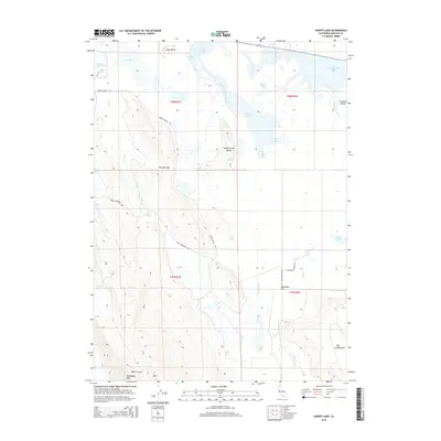
2015 Map of Sheepy Lake
USGS Topo · Published 2015About this map
Sheepy Lake and the surrounding wetlands dominate this 2015 study of the California-Oregon border region in Siskiyou County. The landscape is a complex network of managed water and natural basins, including Lower Klamath Lake and Indian Tom Lake, connected by the Klamath Strait Drain. Notable islands such as Otey Island and Sheepy Creek Island emerge from the water bodies, while the southern terrain rises sharply toward Mahogany Mtn and the wide plateau of Big Tableland. The transition from the aquatic environments of Lake Miller to the dry stretches of Oklahoma Flat illustrates the distinct local topography. Cultural markers like Oklahoma School Rd and Dorris Brownell Rd hint at the historical settlement and agricultural access points used by local families in this part of the Klamath Basin.
Find a feature on this map
30 named features on this map. Tap any name to fly to it.
Don’t see what you’re looking for? This feature index may not catch every label — zoom into the map to look around manually.
Map Details
Editions of this 2015 Sheepy Lake Map
This is the sole edition of this map. No revisions or reprints were ever made.
Other maps of this area

1886 · Modoc Lava Bed
USGS Topo · 1:250,000

1889 · Klamath
USGS Topo · 1:250,000

1892 · Modoc Lava-Bed
USGS Topo · 1:250,000

1894 · Klamath
USGS Topo · 1:250,000

1950 · Mt. Dome
USGS Topo · 1:62,500

1950 · Dorris
USGS Topo · 1:62,500

1954 · Alturas
USGS Topo · 1:250,000

1955 · Klamath Falls
USGS Topo · 1:250,000

1957 · Merrill
USGS Topo · 1:62,500

1957 · Klamath Falls
USGS Topo · 1:62,500