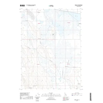
2018 Map of Sheepy Lake
USGS Topo · Published 2018About this map
Oklahoma Flat and the expansive marshlands of the Klamath Basin characterize this high-desert landscape near the Oregon border. The 2018 survey reveals a complex hydrological network where remnants of historic lakebeds like Indian Tom Lake and Sheepy Lake coexist with irrigation features such as the Klamath Strait Drain. The map documents a transition from the wetland valley floor to the prominent volcanic uplands of Mahogany Mtn and J F Mtn in the south. Local transit and land use are defined by established corridors like Dorris Brownell Rd and Oklahoma School Rd, while terrain features such as Horsefly Gap and Otley Island provide navigational landmarks across the flat basin. This map serves as a record of the modern shoreline and water management patterns in an area historically defined by the fluctuations of Lower Klamath Lake.
Find a feature on this map
32 named features on this map. Tap any name to fly to it.
Don’t see what you’re looking for? This feature index may not catch every label — zoom into the map to look around manually.
Map Details
Editions of this 2018 Sheepy Lake Map
This is the sole edition of this map. No revisions or reprints were ever made.
Other maps of this area

1886 · Modoc Lava Bed
USGS Topo · 1:250,000

1889 · Klamath
USGS Topo · 1:250,000

1892 · Modoc Lava-Bed
USGS Topo · 1:250,000

1894 · Klamath
USGS Topo · 1:250,000

1950 · Mt. Dome
USGS Topo · 1:62,500

1950 · Dorris
USGS Topo · 1:62,500

1954 · Alturas
USGS Topo · 1:250,000

1955 · Klamath Falls
USGS Topo · 1:250,000

1957 · Merrill
USGS Topo · 1:62,500

1957 · Klamath Falls
USGS Topo · 1:62,500