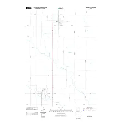
2013 Map of Sheffield
USGS Topo · Published 2013About this map
Sheffield and Rockwell anchor this portion of the northern Iowa prairie, where the landscape is defined by the grid-like precision of county roads and the meandering courses of local waterways. The southern part of the map is dominated by the layout of Sheffield, featuring its street grid from Gilman St to 250th St. To the north, Rockwell sits along a network of numbered avenues and streets, including Main St E and Madison St E. Connecting these two communities is the linear path of US Route 65. Between the settlements, the natural drainage of the land is visible through several winding tributaries, most notably the W Fork Cedar River and Beaverdam Cr, which cut through the agricultural sections defined by roads like Orange Ave and Pheasant Ave.
Find a feature on this map
60 named features on this map. Tap any name to fly to it.
Don’t see what you’re looking for? This feature index may not catch every label — zoom into the map to look around manually.
Map Details
Editions of this 2013 Sheffield Map
This is the sole edition of this map. No revisions or reprints were ever made.
Other maps of this area

1954 · Mason City
USGS Topo · 1:250,000

1954 · Waterloo
USGS Topo · 1:250,000

1955 · Waterloo
USGS Topo · 1:250,000

1957 · Mason City
USGS Topo · 1:250,000

1958 · Mason City
USGS Topo · 1:250,000

1959 · Mason City
USGS Topo · 1:62,500

1959 · Mason City SE
USGS Topo · 1:24,000

1959 · Hanford
USGS Topo · 1:24,000

1972 · Hansell
USGS Topo · 1:24,000
1972 · Dougherty
USGS Topo · 1:24,000