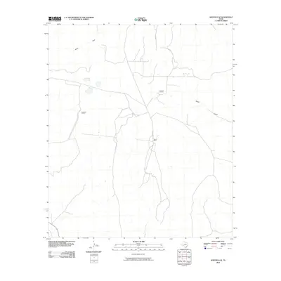
2010 Map of Sheffield SE
USGS Topo · Published 2010About this map
The arid landscape of Terrell County is defined by its deep drainage patterns and scattered ranching outposts as they appeared in 2010. Central to this area is Allison Ranch, where a small network of roads converges near a primary watercourse. The reliance on subterranean water sources is evident through the placement of landmarks like East Martin Windmill and Farm Tank Windmill, which support local activity in a region otherwise dominated by natural features. Large-scale terrain elements such as Reagan Canyon and Harkey Draw dictate the local geography, showing how the natural environment continues to shape the infrastructure of this West Texas territory.
Find a feature on this map
5 named features on this map. Tap any name to fly to it.
Don’t see what you’re looking for? This feature index may not catch every label — zoom into the map to look around manually.
Map Details
Editions of this 2010 Sheffield SE Map
This is the sole edition of this map. No revisions or reprints were ever made.
Other maps of this area

1929 · Sheffield
USGS Topo · 1:125,000

1954 · Sonora
USGS Topo · 1:250,000

1958 · Sonora
USGS Topo · 1:250,000

1967 · Sheffield NW
USGS Topo · 1:24,000

1967 · Horsehead Canyon
USGS Topo · 1:24,000

1967 · Fort Lancaster
USGS Topo · 1:24,000

1967 · Sheffield SE
USGS Topo · 1:24,000

1967 · Dead Man Canyon
USGS Topo · 1:24,000
1967 · Sheffield
USGS Topo · 1:24,000
1973 · Sixshooter Canyon
USGS Topo · 1:24,000