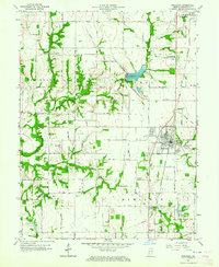
1963 Map of Shelburn
USGS Topo · Published 1978About this map
The town of Shelburn serves as a central hub on this 1963 survey, where the Chicago and Eastern Illinois Railroad facilitates the region's industrial and agricultural transport. The landscape is characterized by the presence of numerous oil wells and coal-related landmarks like Miner City and various unspecified mines, reflecting the intensive resource extraction in Sullivan County during the mid-twentieth century. Water management is evident through features like Thunderbird Pond and the winding course of Turman Creek. For genealogists, the map is a dense record of community life, noting North Central High School, several rural congregations such as Liberty Ch, and localized corners like Benefiel Corner and Benson Cor. The mapping of cemetery sites, including West Lawn Cem and McKinney Cem, provides essential location data for local family history research.
Find a feature on this map
40 named features on this map. Tap any name to fly to it.
Don’t see what you’re looking for? This feature index may not catch every label — zoom into the map to look around manually.
Map Details
Editions of this 1963 Shelburn Map
4 editions found
Other maps of this area

1932 · Marshall
USGS Topo · 1:62,500

1937 · Marshall
USGS Topo · 1:62,500

1940 · Lewis
USGS Topo · 1:24,000

1940 · Pimento
USGS Topo · 1:24,000

1942 · Fairbanks
USGS Topo · 1:24,000

1942 · Shelburn
USGS Topo · 1:24,000

1942 · Hutton
USGS Topo · 1:24,000

1943 · Merom
USGS Topo · 1:24,000

1943 · Hymera
USGS Topo · 1:24,000

1943 · Sullivan
USGS Topo · 1:24,000