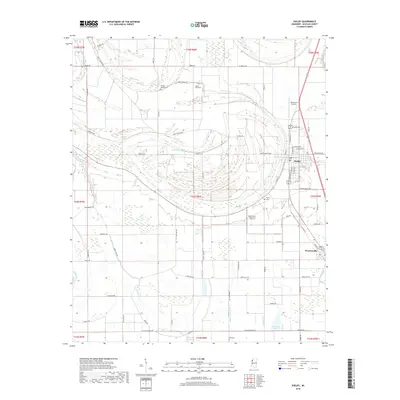
2018 Map of Shelby
USGS Topo · Published 2018About this map
Shelby and Winstonville anchor this portion of Bolivar County, where the agricultural landscape of the Mississippi Delta is defined by a complex network of bayous and ancient river scrolls. The hydrology of the region is prominent, featuring the meandering course of Turkey Pen Bayou, the wider Bogue Phalia to the west, and numerous smaller channels like Little Bradford Bayou and Dry Bayou. These waterways influence the placement of local cemeteries such as Turners Chapel Cem and Peters Rock Cem, often found on slightly higher ground near former stream bends.
Find a feature on this map
78 named features on this map. Tap any name to fly to it.
Don’t see what you’re looking for? This feature index may not catch every label — zoom into the map to look around manually.
Map Details
Editions of this 2018 Shelby Map
This is the sole edition of this map. No revisions or reprints were ever made.
Other maps of this area

1930 · Mellwood
USGS Topo · 1:62,500

1931 · Drew
USGS Topo · 1:48,000

1935 · Clarksdale
USGS Topo · 1:62,500

1935 · Mound Bayou
USGS Topo · 1:62,500

1939 · Pace
USGS Topo · 1:62,500

1939 · Clarksdale
USGS Topo · 1:62,500

1939 · Mellwood
USGS Topo · 1:62,500

1948 · Helena
USGS Topo · 1:250,000

1950 · Helena
USGS Topo · 1:250,000

1953 · Greenwood
USGS Topo · 1:250,000