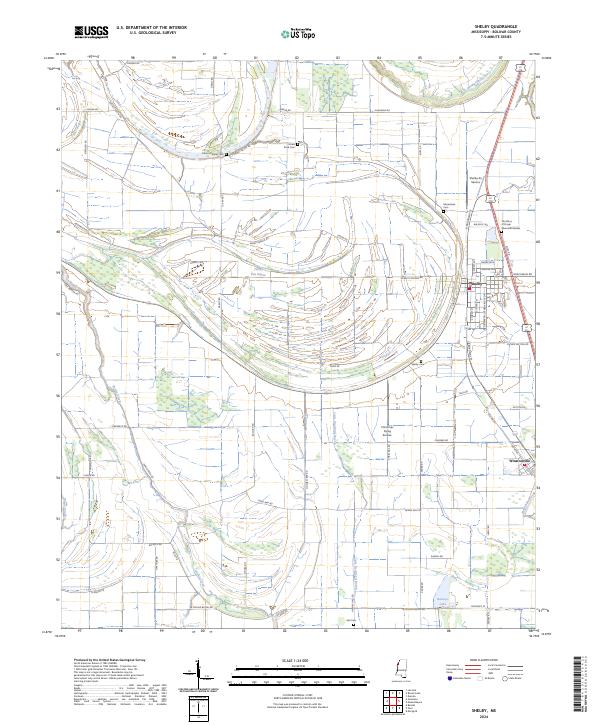
2024 Map of Shelby
USGS Topo · Published 2024About this map
The town of Shelby and the village of Winstonville anchor this portion of the Mississippi Delta, where the landscape is defined by the intricate meandering of ancient waterways. The Hushpuckena River curves across the northern boundary, while the interior is etched with numerous smaller streams like Turkey Pen Bayou, Snake Creek, and Little Bradford Bayou. The rectangular road grid, featuring routes such as Shelby Deeson Rd and Bullock Rd, cuts across these natural oxbows, reflecting the region's agricultural organization. Local history is preserved in a high concentration of cemeteries and sacred spaces, including Macedonia Cem, Turners Chapel Cem, and The Place of Prayer Memorial Garden. Aviation interests are represented by Shelby Air Service and Christmas Flying Service, situated among the flatlands once held as Farm Service Agency Interest of Mississippi land.
Find a feature on this map
74 named features on this map. Tap any name to fly to it.
Don’t see what you’re looking for? This feature index may not catch every label — zoom into the map to look around manually.
Map Details
Editions of this 2024 Shelby Map
This is the sole edition of this map. No revisions or reprints were ever made.
Other maps of this area

1930 · Mellwood
USGS Topo · 1:62,500

1931 · Drew
USGS Topo · 1:48,000

1935 · Clarksdale
USGS Topo · 1:62,500

1935 · Mound Bayou
USGS Topo · 1:62,500

1939 · Pace
USGS Topo · 1:62,500

1939 · Clarksdale
USGS Topo · 1:62,500

1939 · Mellwood
USGS Topo · 1:62,500

1948 · Helena
USGS Topo · 1:250,000

1950 · Helena
USGS Topo · 1:250,000

1953 · Greenwood
USGS Topo · 1:250,000