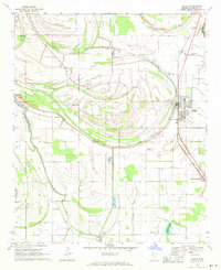
1969 Map of Shelby
USGS Topo · Published 1971About this map
Meandering bayous and fertile bottomlands define this Delta landscape near Shelby and Winstonville in the late 1960s. The Illinois Central railroad corridor serves as the primary north-south axis, around which these agricultural communities are anchored. The terrain is marked by complex water systems, including the dramatic curves of Turkey Pen Bayou and Holmes Lake, reflecting the ancient movements of the Hushpuckena River.
Find a feature on this map
41 named features on this map. Tap any name to fly to it.
Don’t see what you’re looking for? This feature index may not catch every label — zoom into the map to look around manually.
Map Details
Editions of this 1969 Shelby Map
This is the sole edition of this map. No revisions or reprints were ever made.
Other maps of this area

1930 · Mellwood
USGS Topo · 1:62,500

1931 · Drew
USGS Topo · 1:48,000

1935 · Clarksdale
USGS Topo · 1:62,500

1935 · Mound Bayou
USGS Topo · 1:62,500

1939 · Pace
USGS Topo · 1:62,500

1939 · Clarksdale
USGS Topo · 1:62,500

1939 · Mellwood
USGS Topo · 1:62,500

1948 · Helena
USGS Topo · 1:250,000

1950 · Helena
USGS Topo · 1:250,000

1953 · Greenwood
USGS Topo · 1:250,000