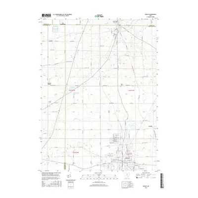
2016 Map of Shelby
USGS Topo · Published 2016About this map
Shelby anchors the southern portion of this landscape, where the Black Fork Mohican River winds through a town defined by its grid of local streets like Republic Ave and Martin Rd. To the north, the terrain transitions into a highly structured agricultural layout along the borders of Huron Co, Richland Co, and Crawford Co. This 2016 survey captures the precise intersection of three counties, marked by long straight corridors such as Base Line Rd W.
Find a feature on this map
72 named features on this map. Tap any name to fly to it.
Don’t see what you’re looking for? This feature index may not catch every label — zoom into the map to look around manually.
Map Details
Editions of this 2016 Shelby Map
This is the sole edition of this map. No revisions or reprints were ever made.
Other maps of this area

1915 · Norwalk
USGS Topo · 1:62,500

1915 · Siam
USGS Topo · 1:62,500

1915 · Bucyrus
USGS Topo · 1:62,500

1915 · Crestline
USGS Topo · 1:62,500

1943 · Bucyrus
USGS Topo · 1:62,500

1943 · Crestline
USGS Topo · 1:62,500

1944 · Norwalk
USGS Topo · 1:62,500

1950 · Marion
USGS Topo · 1:250,000

1956 · Toledo
USGS Topo · 1:250,000

1960 · North Robinson
USGS Topo · 1:24,000