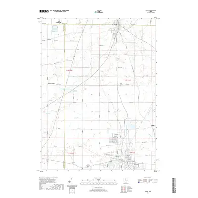
2019 Map of Shelby
USGS Topo · Published 2019About this map
The city of Shelby anchors the southern portion of this landscape, situated along the Black Fork Mohican River and Bear Run. This region at the junction of Richland, Crawford, and Huron counties is defined by its agricultural grid and the drainage systems of Marsh Run and the West Huron River. To the north, the village of Plymouth straddles the county line, featuring established landmarks like Green Lawn Cem and Pioneer Rest Cem. Between these two population centers, the landscape is punctuated by smaller settlements such as Auburn Center and London. Water management is prominent in the northwest, where the Celeryville Reservoir and nearby Cooke Pond Number One suggest the area's specialized local industry. Numerous family-named roads and rural cemeteries, including Hanna Cem and Myers Cem, provide specific points of interest for those tracing the local genealogy and land use patterns of this north-central Ohio corridor.
Find a feature on this map
76 named features on this map. Tap any name to fly to it.
Don’t see what you’re looking for? This feature index may not catch every label — zoom into the map to look around manually.
Map Details
Editions of this 2019 Shelby Map
This is the sole edition of this map. No revisions or reprints were ever made.
Other maps of this area

1915 · Norwalk
USGS Topo · 1:62,500

1915 · Siam
USGS Topo · 1:62,500

1915 · Bucyrus
USGS Topo · 1:62,500

1915 · Crestline
USGS Topo · 1:62,500

1943 · Bucyrus
USGS Topo · 1:62,500

1943 · Crestline
USGS Topo · 1:62,500

1944 · Norwalk
USGS Topo · 1:62,500

1950 · Marion
USGS Topo · 1:250,000

1956 · Toledo
USGS Topo · 1:250,000

1960 · North Robinson
USGS Topo · 1:24,000