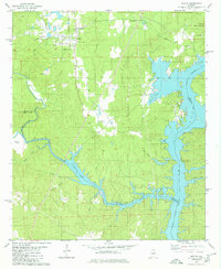
1980 Map of Shelby
USGS Topo · Published 1980About this map
Shelby serves as the focal point of this 1980 survey, where the Louisville and Nashville railroad cuts through the center of town. The landscape is defined by the expansive waters of Lay Lake, created by the impoundment of the Coosa River. This water body reaches deep into the terrain via fingers like Waxahatchee Creek and Kewahatchie Creek, creating a highly irregular shoreline that dictated local settlement patterns and access.
Find a feature on this map
36 named features on this map. Tap any name to fly to it.
Don’t see what you’re looking for? This feature index may not catch every label — zoom into the map to look around manually.
Map Details
Editions of this 1980 Shelby Map
2 editions found
Other maps of this area

1890 · Bessemer
USGS Topo · 1:125,000

1890 · Talladega
USGS Topo · 1:125,000

1891 · Clanton
USGS Topo · 1:125,000

1892 · Talladega
USGS Topo · 1:125,000

1892 · Bessemer
USGS Topo · 1:125,000

1901 · Wetumpka
USGS Topo · 1:125,000

1903 · Wetumpka
USGS Topo · 1:125,000

1909 · Columbiana
USGS Topo · 1:62,500

1911 · Columbiana
USGS Topo · 1:62,500

1915 · Gantts Quarry
USGS Topo · 1:48,000