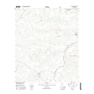
2016 Map of Shelbyville
USGS Topo · Published 2016About this map
Shelbyville anchors this survey of eastern Texas, where the local landscape is defined by the dense drainage network flowing toward the Sabine National Forest. The map documents a rural environment characterized by small settlements like Antioch, Campti, and James, connected by an intricate web of county roads. These communities are situated among prominent terrain features such as Bone Hill and numerous water bodies, including Bone Hill Lake and Windham Lake.
Find a feature on this map
71 named features on this map. Tap any name to fly to it.
Don’t see what you’re looking for? This feature index may not catch every label — zoom into the map to look around manually.
Map Details
Editions of this 2016 Shelbyville Map
This is the sole edition of this map. No revisions or reprints were ever made.
Other maps of this area

1944 · Logansport
USGS Topo · 1:62,500

1944 · Patroon
USGS Topo · 1:62,500

1953 · Alexandria
USGS Topo · 1:250,000

1953 · Palestine
USGS Topo · 1:250,000

1955 · Alexandria
USGS Topo · 1:250,000

1956 · Logansport
USGS Topo · 1:62,500

1956 · Patroon
USGS Topo · 1:62,500

1957 · Palestine
USGS Topo · 1:250,000

1958 · Center
USGS Topo · 1:62,500

1958 · San Augustine
USGS Topo · 1:62,500