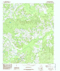
1984 Map of Shelbyville
USGS Topo · Published 1985About this map
Shelbyville serves as the focal point of this East Texas survey, situated within a landscape defined by the dense woodlands of the Sabine National Forest. The settlement pattern is characterized by small rural centers such as Antioch, Plum, and Sardis, each anchored by its respective local church—Antioch Ch, Plum Ch, and Sardis Ch. This distribution reflects the historical importance of community congregations in the area's social fabric.
Find a feature on this map
35 named features on this map. Tap any name to fly to it.
Don’t see what you’re looking for? This feature index may not catch every label — zoom into the map to look around manually.
Map Details
Editions of this 1984 Shelbyville Map
This is the sole edition of this map. No revisions or reprints were ever made.
Other maps of this area

1944 · Logansport
USGS Topo · 1:62,500

1944 · Patroon
USGS Topo · 1:62,500

1953 · Alexandria
USGS Topo · 1:250,000

1953 · Palestine
USGS Topo · 1:250,000

1955 · Alexandria
USGS Topo · 1:250,000

1956 · Logansport
USGS Topo · 1:62,500

1956 · Patroon
USGS Topo · 1:62,500

1957 · Palestine
USGS Topo · 1:250,000

1958 · Center
USGS Topo · 1:62,500

1958 · San Augustine
USGS Topo · 1:62,500