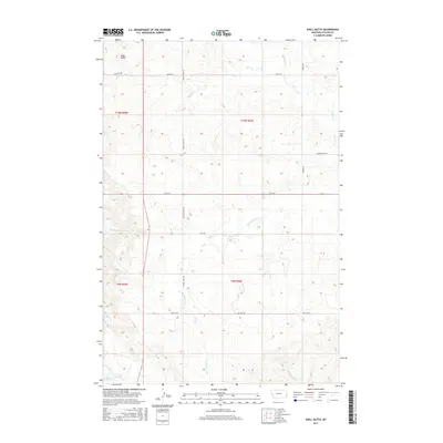
2017 Map of Shell Butte
USGS Topo · Published 2017About this map
Shell Butte rises as a prominent landmark in this eastern Montana landscape, situated near the intersection of several historic transit routes. This area of Fallon County is defined by its drainage systems, with Beaver Cr and its various tributaries, including the Fork of Beaver Cr and Middle Fork Cabin Cr, carving paths through the terrain. The presence of named tracks like the Custer Camp Trl and Sage Trl suggests a history of cattle driving or early military movement across these open plains.
Find a feature on this map
19 named features on this map. Tap any name to fly to it.
Don’t see what you’re looking for? This feature index may not catch every label — zoom into the map to look around manually.
Map Details
Editions of this 2017 Shell Butte Map
This is the sole edition of this map. No revisions or reprints were ever made.
Other maps of this area

1953 · Miles City
USGS Topo · 1:250,000

1957 · Miles City
USGS Topo · 1:250,000

1958 · Miles City
USGS Topo · 1:250,000

1981 · Baker
USGS Topo · 1:100,000

1981 · Baker NE
USGS Topo · 1:24,000
1981 · Morris Butte
USGS Topo · 1:24,000

1981 · Cap Rock
USGS Topo · 1:24,000
1981 · Badland Draw
USGS Topo · 1:24,000
1981 · Shell Butte
USGS Topo · 1:24,000

1981 · Carlyle
USGS Topo · 1:24,000