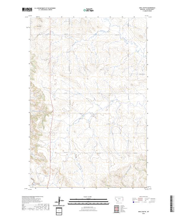
2024 Map of Shell Butte
USGS Topo · Published 2024About this map
Shell Butte rises as the defining landmark in this corner of Fallon County, Montana, overseeing a high plains landscape etched by an intricate network of drainages. The local geography is shaped by the movement of water through the Spring Creek and Beaver Creek systems, which feed into the Fork of Beaver Creek. This map reveals a territory organized for transit and ranching, where modern infrastructure follows old-established pathways through the breaks. Named routes like Custer Camp Trl and Snake Trl suggest a long history of navigation across these coulees. Further south, the landscape is defined by the headwaters of Cabin Creek and Middle Fork Cabin Creek, alongside the remote Cannonball Creek, illustrating the detailed hydrography that has sustained this livestock-producing region into the twenty-first century.
Find a feature on this map
19 named features on this map. Tap any name to fly to it.
Don’t see what you’re looking for? This feature index may not catch every label — zoom into the map to look around manually.
Map Details
Editions of this 2024 Shell Butte Map
This is the sole edition of this map. No revisions or reprints were ever made.
Other maps of this area

1953 · Miles City
USGS Topo · 1:250,000

1957 · Miles City
USGS Topo · 1:250,000

1958 · Miles City
USGS Topo · 1:250,000

1981 · Baker
USGS Topo · 1:100,000

1981 · Baker NE
USGS Topo · 1:24,000
1981 · Morris Butte
USGS Topo · 1:24,000

1981 · Cap Rock
USGS Topo · 1:24,000
1981 · Badland Draw
USGS Topo · 1:24,000
1981 · Shell Butte
USGS Topo · 1:24,000

1981 · Carlyle
USGS Topo · 1:24,000