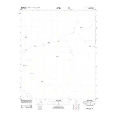
2011 Map of Shelley Peak
USGS Topo · Published 2011About this map
Shelley Peak stands as a prominent high point within the Mogollon Mountains of Grant County, anchoring a landscape defined by an intricate network of deep canyons and seasonal drainages. This high-altitude drainage basin centers on the Mogollon Creek and its primary tributary, the South Fork Mogollon Creek, which carve through the volcanic terrain. Evidence of past mineral exploration is visible at the Seventy Four Mountain Prospect, located near Seventyfour Mountain Tank. The geography is characterized by specifically named natural features that suggest a history of ranching and backcountry use, including Buds Hole, Gobbler Canyon, and Tepee Canyon. Water management in this arid mountain environment is highlighted by the presence of isolated water catchments such as Deadman Tank, which sit along the drainages of Deadman Canyon and Lookout Canyon.
Find a feature on this map
20 named features on this map. Tap any name to fly to it.
Don’t see what you’re looking for? This feature index may not catch every label — zoom into the map to look around manually.
Map Details
Editions of this 2011 Shelley Peak Map
This is the sole edition of this map. No revisions or reprints were ever made.
Other maps of this area

1910 · Mogollon
USGS Topo · 1:125,000

1911 · Alum Mountain
USGS Topo · 1:125,000

1912 · Mogollon
USGS Topo · 1:125,000

1913 · Alum Mountain
USGS Topo · 1:125,000

1954 · Clifton
USGS Topo · 1:250,000

1957 · Clifton
USGS Topo · 1:250,000

1958 · Clifton
USGS Topo · 1:250,000

1962 · Clifton
USGS Topo · 1:250,000
1965 · Canteen Canyon
USGS Topo · 1:24,000
1965 · Diablo Range
USGS Topo · 1:24,000