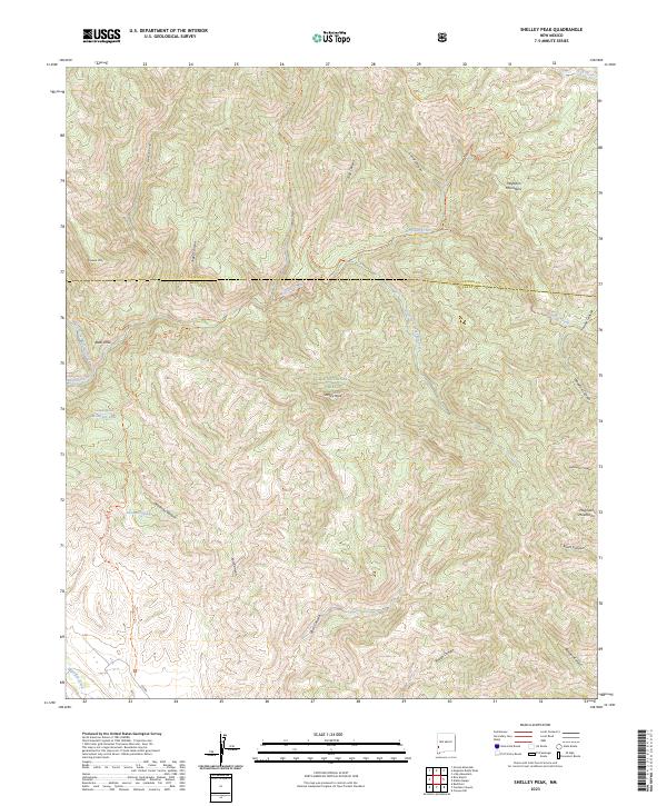
2023 Map of Shelley Peak
USGS Topo · Published 2023About this map
The Mogollon Mountains dominate this high-altitude landscape within the Gila National Forest, where the topography is defined by a dense network of drainages and peaks. Shelley Peak serves as a central landmark, surrounded by significant relief features like Lookout Mtn and numerous deep-cut ravines including Deadman Canyon, Fall Canyon, and Rough Canyon. The intricate hydrology of the region is centered on the Mogollon Creek and its tributaries, including the South Fork Mogollon Creek and West Fork Mogollon Creek.
Find a feature on this map
36 named features on this map. Tap any name to fly to it.
Don’t see what you’re looking for? This feature index may not catch every label — zoom into the map to look around manually.
Map Details
Editions of this 2023 Shelley Peak Map
This is the sole edition of this map. No revisions or reprints were ever made.
Other maps of this area

1910 · Mogollon
USGS Topo · 1:125,000

1911 · Alum Mountain
USGS Topo · 1:125,000

1912 · Mogollon
USGS Topo · 1:125,000

1913 · Alum Mountain
USGS Topo · 1:125,000

1954 · Clifton
USGS Topo · 1:250,000

1957 · Clifton
USGS Topo · 1:250,000

1958 · Clifton
USGS Topo · 1:250,000

1962 · Clifton
USGS Topo · 1:250,000
1965 · Canteen Canyon
USGS Topo · 1:24,000
1965 · Diablo Range
USGS Topo · 1:24,000