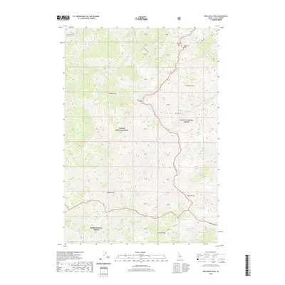
2020 Map of Shellrock Peak
USGS Topo · Published 2020About this map
Shellrock Peak stands as the central topographic focal point in this high-elevation landscape where three major federal land jurisdictions converge. The boundaries of the Payette National Forest, Salmon National Forest, and Boise National Forest meet in a complex drainage system defined by deep canyons and prominent ridges. A network of alpine waters including Norton Lake and Brush Creek carve through the terrain, supporting a watershed that feeds into several distinct creek systems such as Trail Cr and Sheep Cr. The map illustrates the specialized land management of the early 21st century, showing how modern trail systems like Trail navigate the steep gradients between Two Point Peak and Norton Ridge. This specific quadrangle serves as a detailed record of the intersections between wilderness preservation and the high mountain geography of Idaho's interior.
Find a feature on this map
36 named features on this map. Tap any name to fly to it.
Don’t see what you’re looking for? This feature index may not catch every label — zoom into the map to look around manually.
Map Details
Editions of this 2020 Shellrock Peak Map
This is the sole edition of this map. No revisions or reprints were ever made.
Other maps of this area

1930 · Casto
USGS Topo · 1:125,000

1956 · Elk City
USGS Topo · 1:250,000

1957 · Challis
USGS Topo · 1:250,000

1960 · Elk City
USGS Topo · 1:250,000

1960 · Challis
USGS Topo · 1:250,000

1962 · Mormon Mtn
USGS Topo · 1:24,000

1962 · Bear Creek Point
USGS Topo · 1:24,000

1962 · Norton Ridge
USGS Topo · 1:24,000

1962 · Shellrock Peak
USGS Topo · 1:24,000

1962 · Dave Lewis Peak
USGS Topo · 1:24,000