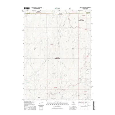
2015 Map of Shelly Creek Ridge
USGS Topo · Published 2015About this map
Middle Fork Smith River carves through the convergence of the Siskiyou National Forest and Six Rivers National Forest, marking a landscape defined by sharp elevation changes and dense drainage networks. Small clearings such as Baker Flat, Horse Flat, and Washington Flat provide rare level ground among the high points of Shelly Creek Ridge and Washington Peak. The presence of the Old Gasquet Toll Rd in the southwestern corner offers a glimpse into early transportation routes that preceded modern highway systems through these mountains. The settlement of Idlewild and the site at Patrick Creek serve as localized human landmarks within an otherwise dominant wilderness terrain. The map meticulously documents dozens of named drainages, including Diamond Cr, Broken Kettle Cr, and Monkey Cr, illustrating the complex watershed that feeds the regional river system along the California and Oregon border.
Find a feature on this map
49 named features on this map. Tap any name to fly to it.
Don’t see what you’re looking for? This feature index may not catch every label — zoom into the map to look around manually.
Map Details
Editions of this 2015 Shelly Creek Ridge Map
This is the sole edition of this map. No revisions or reprints were ever made.
Other maps of this area

1917 · Kerby
USGS Topo · 1:125,000

1918 · Kerby
USGS Topo · 1:125,000

1922 · Preston Peak
USGS Topo · 1:125,000

1945 · Kerby
USGS Topo · 1:125,000

1945 · Gasquet
USGS Topo · 1:62,500

1948 · Weed
USGS Topo · 1:250,000

1950 · Weed
USGS Topo · 1:250,000

1951 · Gasquet
USGS Topo · 1:62,500

1954 · Cave Junction
USGS Topo · 1:62,500

1954 · Chetco Peak
USGS Topo · 1:62,500