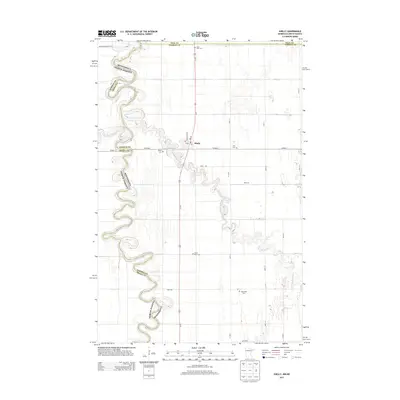
2013 Map of Shelly
USGS Topo · Published 2013About this map
The Red River Valley landscape is defined by the winding border between Minnesota and North Dakota, where the town of Shelly serves as a small hub for the surrounding agricultural community. The terrain is notably flat, carved primarily by the meandering paths of the Goose River and the Marsh River, which snake through the fertile plains. This 2013 survey illustrates a high density of rural burial sites relative to the sparse population, including Saint Petri Cem, Shelly Cem, Zion Cem, Marsh River Cem, and Augustana Cem. These sites, often positioned near local watercourses or major transit lines like Us-75, serve as quiet anchors for family history in Norman County. The map also detail local infrastructure such as the post office and the Burlington St corridor, reflecting the continued importance of rail and road connections in this borderland region.
Find a feature on this map
28 named features on this map. Tap any name to fly to it.
Don’t see what you’re looking for? This feature index may not catch every label — zoom into the map to look around manually.
Map Details
Editions of this 2013 Shelly Map
This is the sole edition of this map. No revisions or reprints were ever made.
Other maps of this area

1918 · Hendrum
USGS Topo · 1:62,500

1919 · Eldred
USGS Topo · 1:62,500

1919 · Beltrami
USGS Topo · 1:62,500

1924 · Ada
USGS Topo · 1:62,500

1952 · Grand Forks
USGS Topo · 1:250,000

1956 · Grand Forks
USGS Topo · 1:250,000

1963 · Shelly
USGS Topo · 1:24,000

1963 · Halstad
USGS Topo · 1:24,000

1963 · Halstad SW
USGS Topo · 1:24,000

1964 · Beltrami SW
USGS Topo · 1:24,000